Atlantic Storm Front Threatens to Bury Midlands and Wales Under Heavy Snow
Met Office Issues Yellow Warning as Four-Inch Accumulations Loom for Higher Elevations

Callum Smith
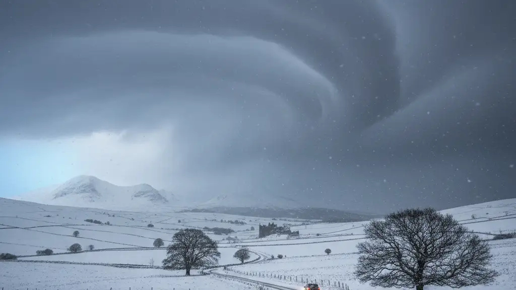
A potent Atlantic storm system will collide with frigid air over the United Kingdom on Wednesday, triggering a yellow weather warning for snow across the West Midlands and Wales.
National Weather Agency experts warned that outbreaks of rain, hill snow, and aggressive winds will likely fracture travel networks throughout the day. These conditions create a high-stakes environment for both commuters and emergency responders.
Commuters face potential chaos tomorrow morning as precipitation transitions to snow on elevated routes above 150 metres. This altitude serves as the critical threshold where rain loses its battle against the plummeting mercury.
Met Office meteorologists expect 2-5cm of snow to accumulate widely at these altitudes, with the most severe impacts hitting Herefordshire and Shropshire. The sheer weight of the snowfall could test the resilience of local power grids and communications.
Lower elevations are not immune to the disruption, as experts predict up to 2cm of slushy accumulation could settle by early Thursday morning. Even this modest layer poses a significant risk to pedestrian safety and urban traffic flow.
Strong east to northeasterly winds will accompany the moisture, threatening to whip the snowfall into drifts and further reduce visibility on major motorways. These gusts transform a standard snowfall into a blinding, navigational hazard.
The Met Office confirmed that the combination of ice and wind could trigger significant delays at airports and across the national rail network. Logistics hubs are bracing for a ripple effect that could stall commerce across the Midlands.
Telford and Warwickshire also sit within the impact zone, where local authorities brace for the first major winter disruption of the season. Preparation efforts have intensified as the window for preventative action narrows.
This collision of Atlantic moisture and Arctic air creates a volatile atmospheric cocktail that often paralyses the UK's ageing infrastructure. The fragility of the nation's transport backbone becomes painfully apparent under such thermal stress.
Engineers and gritters are mobilising across the Midlands to treat primary routes, though the sheer volume of predicted snow may overwhelm standard mitigation efforts. Salt and brine can only do so much against a sustained polar assault.
Beyond the urban centres, the 15cm totals projected for Welsh peaks represent a significant hazard for rural communities where road access is frequently severed. For these residents, the storm represents a period of enforced isolation.
Visibility on the M5 and M6 corridors is expected to plummet as the northeasterly winds intensify, creating whiteout conditions for long-haul haulage drivers. These motorways serve as the nation's economic veins, now threatened by a sudden arterial clog.
Rail operators have already begun advising passengers to check for cancellations, as frozen points and snow-clogged tracks historically derail morning schedules. The precision of the rail network is no match for the blunt force of a winter freeze.
The transition from rain to snow at 150 metres creates a treacherous 'freeze-thaw' cycle that can turn asphalt into a skating rink within minutes. This invisible layer of black ice often proves more dangerous than the visible snow itself.
Emergency services are urging residents in the yellow warning zone to secure loose outdoor items and prepare for potential power outages caused by wind-snapped branches. Vigilance is the primary currency for those living in the path of the gale.
As the front pushes eastward, the lingering slush in lower-lying areas like Worcester and Birmingham will likely freeze solid overnight into Thursday. This secondary freeze ensures that the disruption will outlast the initial snowfall.
This storm serves as a stark reminder of the UK's vulnerability to sudden shifts in the North Atlantic oscillation during the late winter months. Our climate remains a theatre of extremes where stability is never guaranteed.
The Met Office continues to monitor the trajectory of the low-pressure centre, as even a slight shift in its path could pull the heaviest snow bands into more densely populated urban centres. The margin for error remains razor-thin as the cold front deepens its hold.